
Geospatial Analysis and Quantification of Terrain Change
We have developed a methodology for quantification of complex, short-term terrain evolution based on spatial approximation with simultaneous surface geometry analysis. Generalized multivariate smoothing spline with tension was applied to create a multitemporal, high resolution set of DEMs from different types of point cloud elevation data. Simultaneously with approximation, terrain parameters were derived at a level of detail needed for the identification and tracking of dynamic terrain features. The methodology was demonstrated for a case study that involved a complex sand dune migration. More research is needed to fully automate tracking and quantification of horizontal migration which requires automated determination of feature movement trajectory.
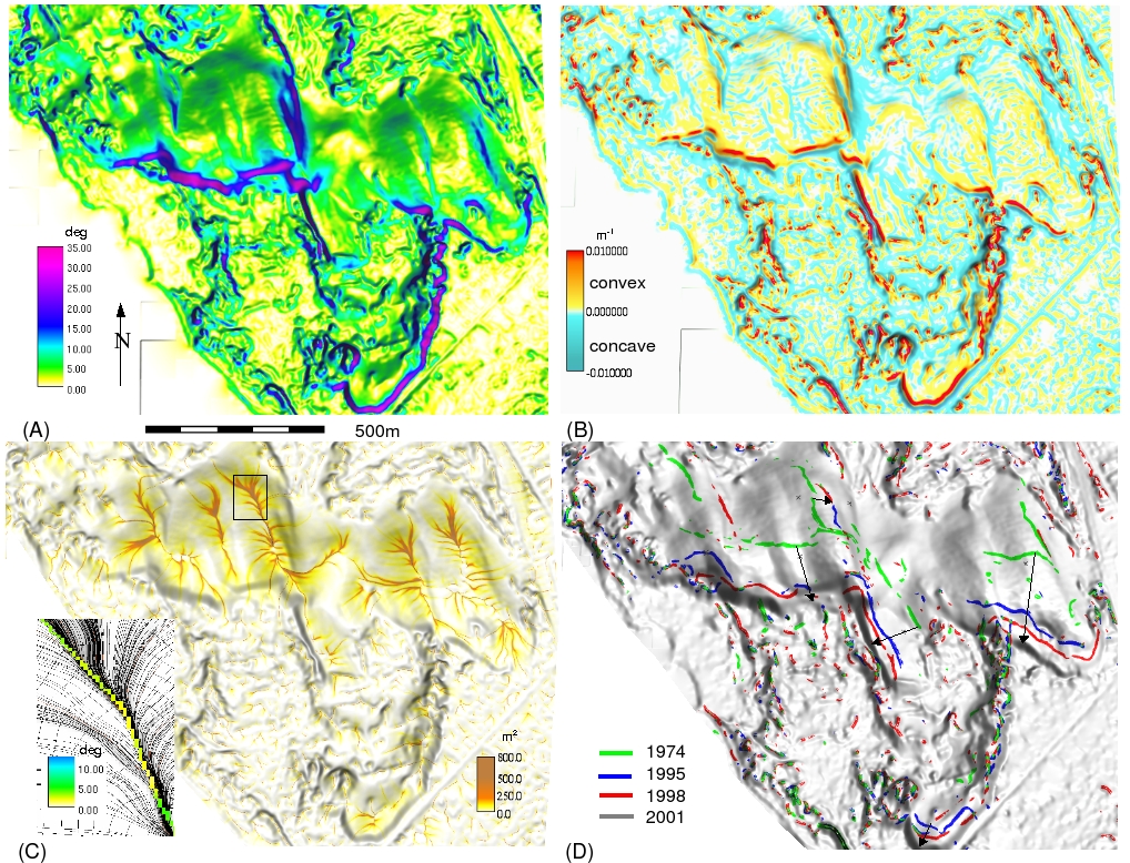
Topographic analysis used to quantify topographic change:
quantification of horizontal dune migration using extracted crests
Full image
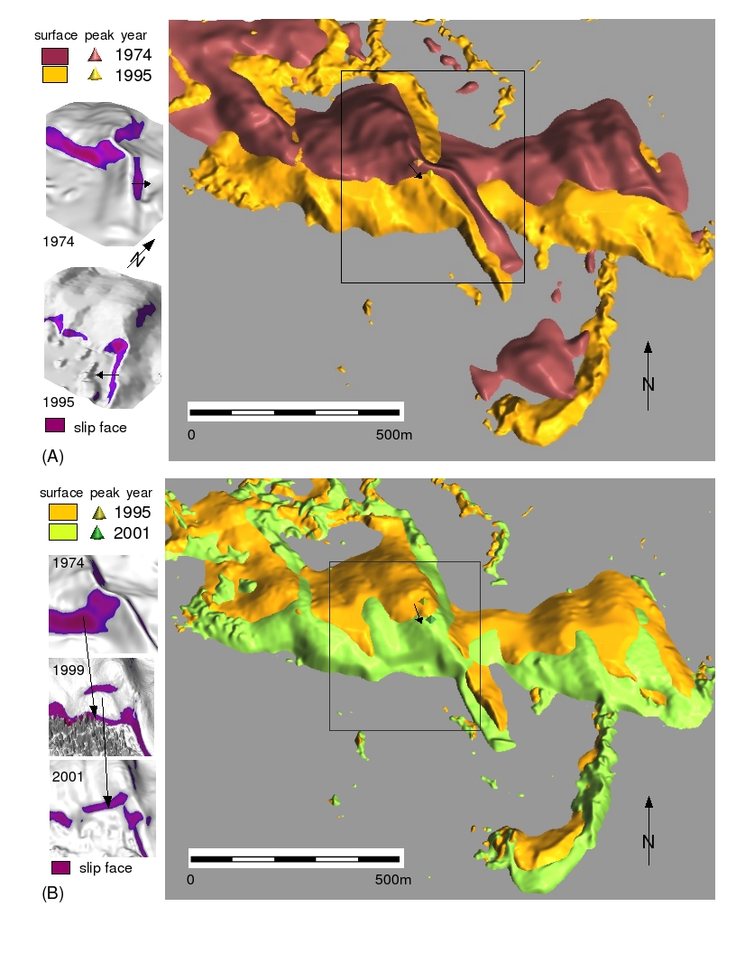
Overlay of dune models illustrating of complex terrain evolution,
inset shows evolution of slip-faces
Full image
Analysis of topographic change requires processing of elevation data with different accuracies and point densities
Full image

Tuning the approximation parameters for optimal level of detail
(left is profile curvature, right image is slope)
Larger image

