Images

Above: Quadtree-based segmentation of lidar point cloud.

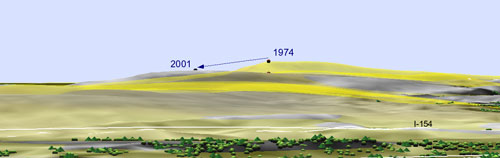
Above: Jockey's Ridge sand dune: 1m resolution lidar-based DEM with color map representing land cover derived aerial photo.

Source: Thanks to Helena Mitasova for use of these images.
